Paramaribo, the capital city of Suriname, sits on a low‑lying coastal plain along the Suriname River and is the heart of the nation’s political, economic and cultural activity. As the city continues to grow, it faces a set of pressing urban planning challenges: traffic congestion, constraints from its historic core, flood risk due to rising sea levels and heavy rainfall, and the need for improved connectivity both within the city and with its surrounding districts. The Paramaribo Ring Road & Urban Upgrades initiatives aim to tackle these challenges through a combination of road infrastructure expansion, urban rehabilitation, and companion projects to boost mobility, resilience, and livability.
1. Strategic Purpose of the Ring Road and Urban Upgrades
The concept of a ring road around Paramaribo is rooted in the need to divert through traffic away from the dense historic center and to provide efficient routes for intra‑urban and regional mobility. Ring roads are highways that encircle a city, offering alternatives to transit through downtown streets. In Paramaribo’s case, such a system would relieve congestion, reduce travel times for goods and commuters, and strengthen connectivity to emerging residential, commercial and industrial areas.
Alongside the ring road concept, the city has initiated urban upgrades, such as the rehabilitation of key historic districts, redesign of urban streets, and enhancement of public spaces. These upgrades integrate transport improvements with heritage preservation and public realm enhancement, contributing to social and economic revitalization.
2. Civil Engineering Concepts in Road Network Expansion
2.1. Ring Road Design and Geometric Planning
Designing a ring road involves careful consideration of geometric standards that ensure safe and efficient vehicle operation. Engineers must determine:
- Horizontal alignment: Curves must be gentle enough to maintain traffic speeds while respecting land use boundaries.
- Vertical alignment: Gradients must balance earthwork costs with vehicle performance, especially for heavy freight traffic.
- Cross‑section design: Determining the number of lanes, median width, shoulders, and clear zones based on projected traffic volume.
Topographic surveys play a critical role in defining the ideal route, particularly in Paramaribo’s flat coastal setting where subtle elevation changes and hydrology influence drainage and construction methods.
2.2. Earthworks and Drainage Integration
A significant portion of the ring road’s construction involves earthworks — excavation, embankment building, and ground stabilization — to create a stable foundation for the pavement layers. On a coastal plain, special attention must be paid to groundwater levels and soil compressibility, as saturated ground can lead to settlement or instability. Engineers often install:
- Subsurface drainage systems (e.g., French drains, perforated pipes)
- Geotextile fabrics to separate soil layers and improve load distribution,
- Embankment reinforcement using rock or engineered fill to ensure stability.
Given Paramaribo’s vulnerability to flooding, road design mandates efficient integration with existing and upgraded drainage canals to prevent water build‑up on road surfaces and adjacent neighborhoods.
2.3. Pavement Engineering and Materials
The ring road’s pavement structure must support heavy vehicles, frequent traffic, and local climatic stresses. Civil engineers select pavement types based on:
- Traffic load projections
- Ground conditions
- Maintenance requirements
Flexible pavements (asphalt layers over base courses) are common for urban rings, allowing easier patching and resurfacing, while rigid pavements (concrete) may be used at key intersections or high‑stress areas. Material selection emphasizes durability in a humid tropical climate, resistance to rutting and cracking, and efficient constructability.
3. Urban Upgrades: Heritage, Mobility and Public Space Design
3.1. Historic Urban Rehabilitation
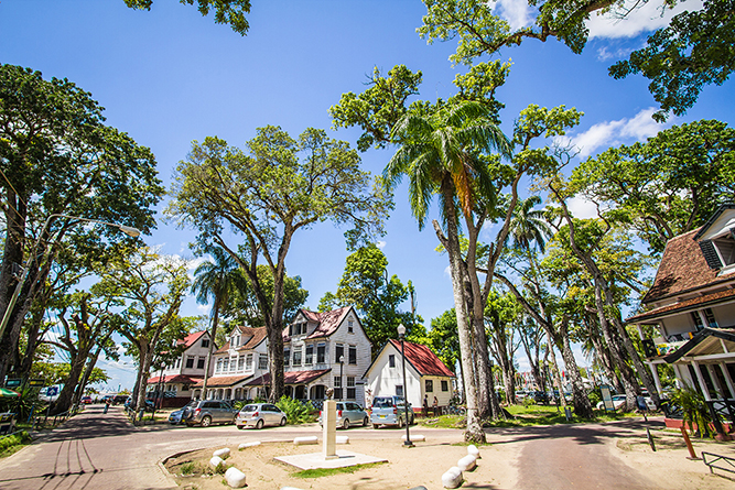
Paramaribo’s historic center is a UNESCO World Heritage Site, known for its wooden architecture that blends Dutch colonial design with tropical adaptations. Rehabilitation projects prioritize the preservation of this heritage while modernizing infrastructure. Architecture and urban design concepts employed include:
- Sensitive restoration of facades, windows, and structural components to retain authenticity.
- Public space redesign that enhances pedestrian circulation, street lighting, landscaping, and accessibility.
- Context‑aware materials that reflect the historic character while meeting modern performance standards.
The goal is to balance preservation with urban functionality, creating public realms that celebrate cultural identity without compromising mobility.
3.2. Streetscape and Mobility Enhancements
Urban upgrades address traffic flow and user experience within the city:
- Widened sidewalks and dedicated non‑motorized lanes improve safety for pedestrians and cyclists.
- Street furniture, lighting and wayfinding systems enhance comfort and navigation for residents and visitors.
- Public transport priority measures — like bus‑only lanes or improved bus stops — encourage efficient, equitable mobility.
These enhancements require coordination between civil engineers, urban designers and traffic planners to ensure that infrastructure serves both functional and aesthetic goals.
4. Integrated Water Management
Paramaribo’s low elevation and proximity to rivers and canals necessitate integration of road upgrades with urban drainage and water management systems. Historically, the city’s canal network was designed for agriculture, not modern urban stormwater demands. Upgrades and rehabilitation of drainage infrastructure — including culverts, main canals and water conveyance channels — improve the city’s resilience against flooding.
Engineering solutions include:
- Reprofiled canals to increase flow capacity
- Sluice and lock rehabilitation to regulate water levels
- Stormwater culverts under roadways to maintain surface drainage without road damage
Such works require hydraulic modeling to forecast water movement during peak rainfall and high river stages, ensuring that road infrastructure remains functional during extreme weather.
5. Traffic Flow Engineering and Safety
A ring road’s purpose is to ease traffic within the city, but urban upgrades also improve safety and flow on local streets:
- Signal timing optimization smooths intersections.
- Roundabouts and grade separation reduce conflict points.
- Crosswalks, refuge islands, and ADA‑compliant curb ramps improve pedestrian safety.
Road markings, signage and lighting designs follow international standards for clarity and legibility, enhancing both day and night safety.
6. Construction Management and Phasing
Large infrastructure programs in urban environments require careful construction phasing to minimize disruption:
- Utility relocation (water, sewer, electricity, telecom) is often the first stage to clear pathways for road works.
- Temporary traffic management ensures access while key sections are built.
- Staging allows adjacent segments to be completed in sequence, reducing congestion.
Close coordination with contractors, city agencies and residents helps manage expectations and maintain mobility throughout construction.
7. Challenges in Delivery
7.1. Site Constraints and Existing Urban Fabric
Paramaribo’s historic core and dense neighborhoods require creative solutions to avoid excessive demolition or displacement. Aligning new infrastructure with existing streets and utilities demands detailed surveys and often opportunistic engineering to optimize space usage.
7.2. Climate and Geotechnical Issues
Being on a coastal plain, the city faces:
- High water tables
- Seasonal heavy rainfall
- Climate change‑related sea level rise
these factors influence ground conditions and drainage design, requiring resilient engineering solutions that can adapt to evolving environmental pressures.
7.3. Funding and Institutional Coordination
Large infrastructure and urban rehabilitation projects typically involve multiple government bodies, funding partners and private stakeholders. Aligning objectives, managing budgets, and coordinating technical standards can be complex, especially when balancing heritage conservation with contemporary infrastructure needs.
8. Broader Urban and Economic Impacts
The ring road and urban upgrades have implications beyond traffic and aesthetics:
- Catalyzing economic activity by improving access to logistics hubs, ports and commercial zones.
- Resilience enhancement by combining road works with drainage improvements.
- Public realm revitalization attracting tourism, business growth, and improved quality of life.
- Equitable mobility by providing safer options for non‑motorized users and public transport access.
Paramaribo’s transformation through infrastructure and urban design positions it to better handle demographic growth, environmental threats, and economic integration in the region.
Conclusion
The Paramaribo Ring Road & Urban Upgrades represent a comprehensive approach to modernizing urban infrastructure while preserving historic character. Through thoughtful civil engineering, strategic traffic planning, contextual architectural design, and resilient water management, the project addresses multiple layers of urban complexity. Delivering such infrastructure in a dynamic coastal capital requires careful phasing, multidisciplinary coordination, and forward‑looking planning. The result promises not only smoother traffic but a more resilient, livable, and prosperous Paramaribo for decades to come.
No responses yet